MeeBhoomi
Andhra Pradesh's official land records portal for transparency and efficiency
What is MeeBhoomi? Complete Overview
MeeBhoomi (మీ భూమి), which translates to 'Your Land' in Telugu, is the official online land records management system launched by the Revenue Department of Andhra Pradesh. Launched in June 2015 as part of the Digital India initiative, MeeBhoomi aims to bring transparency, efficiency, and convenience to land administration by serving as a centralized digital repository for all land-related data across the state. The portal provides easy access to critical land records such as Adangal, 1B, Village Maps, and more. It is managed by the Department of Revenue, specifically the Chief Commissioner of Land Administration (CCLA) office. The primary objective is to ensure that citizens can access their land records online without hassle, reducing corruption and delays in land-related transactions.
MeeBhoomi Interface & Screenshots
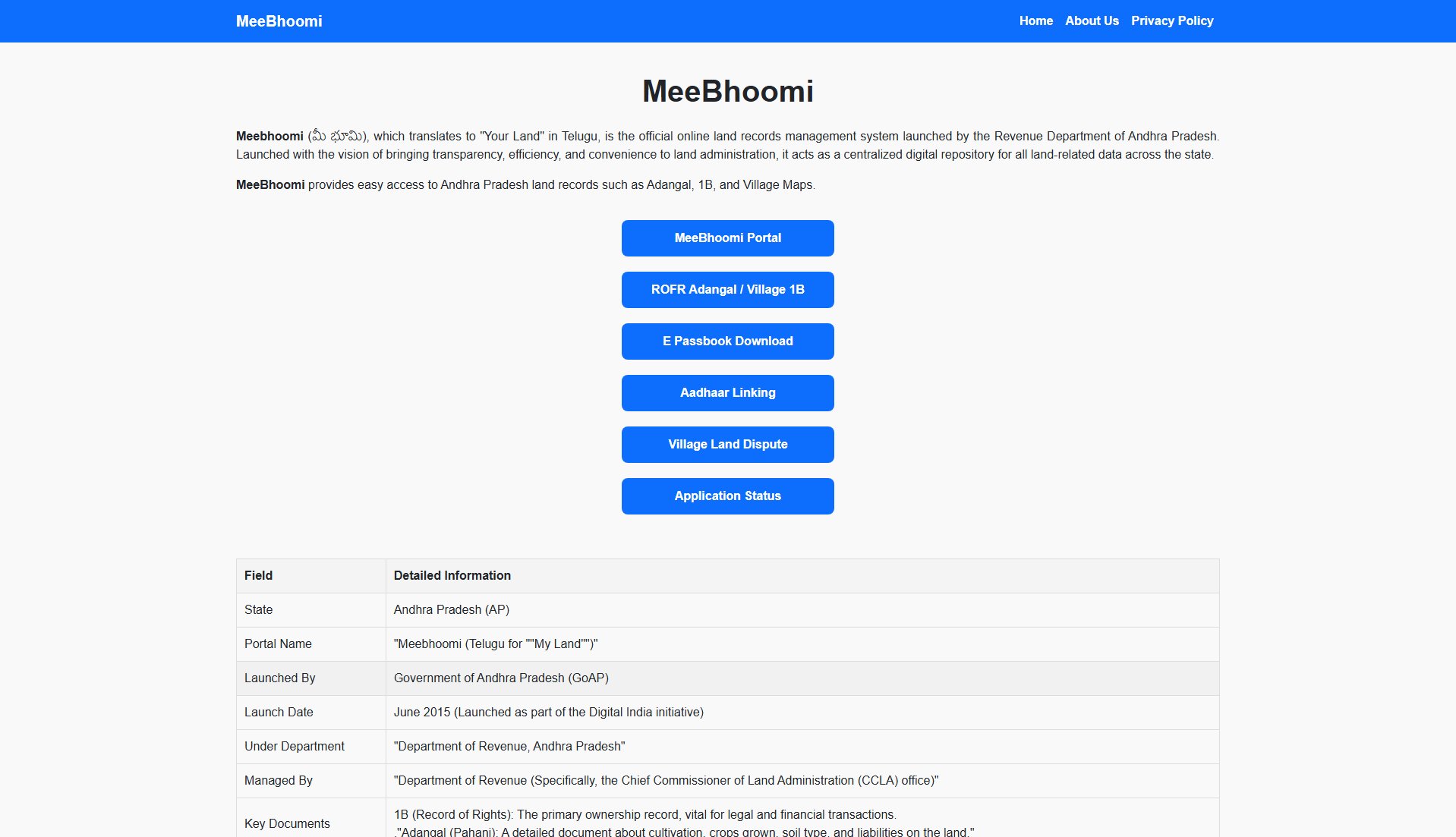
MeeBhoomi Official screenshot of the tool interface
What Can MeeBhoomi Do? Key Features
Adangal (Pahani)
Adangal is a detailed record containing information about land use, crops grown, soil type, irrigation sources, and other agricultural details for a specific survey number. This document is essential for farmers applying for crop insurance and subsidies. It provides a comprehensive overview of the land's agricultural status and liabilities.
1-B (Record of Rights - ROR)
The 1-B document is a key legal record that shows ownership details of the land, including the owner's name, Khata number, extent of the land, and other legal rights and liabilities. It is vital for verifying ownership before a purchase or for securing bank loans. This document serves as official proof of land ownership.
Village Maps and FMB (Field Measurement Book)
The portal provides access to village maps and the Field Measurement Book (FMB), which show the geographical layout and accurate boundary measurements of land plots within a village. These documents are crucial for resolving boundary disputes and verifying land dimensions.
Electronic Passbook (E-Passbook)
The E-Passbook is the digital version of the land ownership passbook, serving as official proof of land ownership. It can be downloaded after verifying details with an OTP sent to the registered mobile number. This feature eliminates the need for physical passbooks and ensures easy access to ownership proof.
Aadhaar Linking Status
Users can check the status of linking their Aadhaar number with their land account. This feature enhances security and verification, ensuring that land records are securely tied to the owner's identity. Aadhaar linking is free of charge.
Application Status Tracking
The portal allows users to track the status of applications for mutation (change of ownership), land conversion, and other services. This feature provides transparency and reduces the need for physical visits to government offices.
Best MeeBhoomi Use Cases & Applications
Land Purchase Verification
Before purchasing land, buyers can use MeeBhoomi to verify the ownership details (1-B) and check for any disputes or liabilities (Adangal). This ensures a transparent and secure transaction.
Crop Insurance Application
Farmers can access their Adangal to provide proof of land use and crop details when applying for crop insurance or government subsidies. This simplifies the application process and reduces paperwork.
Bank Loan Processing
Individuals can download their 1-B and E-Passbook to submit as proof of land ownership when applying for bank loans. This speeds up the loan approval process and reduces dependency on physical documents.
Boundary Dispute Resolution
Landowners can refer to the Village Maps and FMB to resolve boundary disputes with neighbors. The precise measurements and sketches help in clarifying land boundaries.
Mutation Application Tracking
Users can track the status of their mutation applications online, eliminating the need for frequent visits to government offices. This feature ensures transparency and timely updates.
How to Use MeeBhoomi: Step-by-Step Guide
Visit the MeeBhoomi portal at https://mymeebhoomi.com. On the homepage, locate the service you need, such as Adangal, 1-B, or E-Passbook.
Select the relevant option (e.g., 'మీ అడంంగల్ / గ్రామ అడంగల్' for Adangal or 'మీ 1-బి / గ్రామ 1-బి' for 1-B). Choose whether you want to search for your specific land parcel or the village-wide record.
Use the dropdown menus to select your District, Mandal, and Village. Ensure the details are accurate to avoid errors in the search results.
Select your preferred search method: Survey Number, Account Number (Khata No.), Aadhaar Number, or Pattadar Name. Enter the corresponding number or name based on your selection.
Enter the Captcha code shown on the screen and click 'Click' or 'Submit' to view the report. For E-Passbook, you will receive an OTP on your registered mobile number.
Verify the OTP (if applicable) and download or view the required document. Ensure you save or print the document for future reference.
MeeBhoomi Pros and Cons: Honest Review
Pros
Considerations
Is MeeBhoomi Worth It? FAQ & Reviews
MeeBhoomi is the official digital land records management system of the Government of Andhra Pradesh. Its main goal is to provide citizens with easy, online access to their land records, ensuring transparency and reducing corruption.
The two most important records are Adangal (or Pahani), which details agricultural and land-use information, and 1-B (or ROR), which legally confirms land ownership and associated details.
You can search for your records by providing the District, Mandal, and Village name, and then using your Survey Number, Account Number (Khata No.), or Aadhaar Number as the search criteria.
Yes. You can download the Electronic Passbook (E-Passbook), which is the official digital copy of your land ownership certificate (Pattadar Passbook), after verifying your details and mobile number with an OTP.
Yes. The MeeBhoomi portal provides a Village Land Dispute Register where you can check if a specific land parcel (Survey Number) is involved in any ongoing court case or revenue dispute.
The FMB is a set of maps and sketches that shows the precise measurements and boundaries of your land parcel. It is essential for verifying the physical dimensions of the property.
