Unpaved
AI Spatial Engineer transforming complex GIS data into insights
What is Unpaved? Complete Overview
Unpaved is an AI-powered geospatial intelligence platform that simplifies complex spatial data analysis through natural language processing. Designed to democratize GIS capabilities, it eliminates the need for extensive technical training by allowing users to interact with spatial data using plain English. The platform serves a wide range of users from hobbyists to large enterprises, offering tools for geospatial analysis, automated map visualizations, and workflow automation. Unpaved addresses the pain points of traditional GIS software by making spatial analysis accessible, reducing the time from data to insights, and enabling collaboration across teams with varying technical expertise.
Unpaved Interface & Screenshots
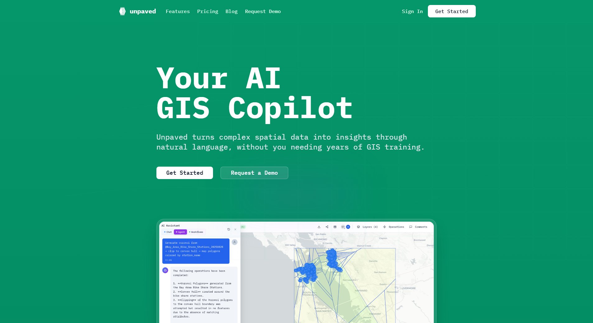
Unpaved Official screenshot of the tool interface
What Can Unpaved Do? Key Features
AI-Powered Spatial Intelligence
Unpaved's advanced AI understands geographic relationships and spatial patterns, allowing users to ask questions in plain English and receive instant insights. This feature transforms complex geospatial analysis into natural conversations, making spatial intelligence accessible to non-technical users while maintaining depth for professionals.
Automated Data Processing
The platform supports 9+ file formats and automatically geocodes addresses with validation. Users can upload various data formats which the system instantly prepares for analysis, providing previews and visualizations without manual data cleaning or transformation.
Workflow Automation
Unpaved enables users to turn repetitive spatial analysis tasks into reusable workflows. These pipelines can be shared across teams, run multiple times with different datasets, and significantly reduce the time needed for routine geospatial operations.
Collaborative Mapping
Teams can share interactive maps with stakeholders and collaborate in real-time. The platform offers embeddable map codes for presentations and supports concurrent editing, making it ideal for distributed teams working with spatial data.
Enterprise-grade Security
Built with security at its core, Unpaved offers flexible deployment options including cloud and on-premise solutions. It features role-based access control, detailed audit trails, and configurable data retention policies for organizations with strict compliance requirements.
Best Unpaved Use Cases & Applications
Urban Planning
City planners use Unpaved to analyze zoning patterns, assess development impacts, and visualize proposed changes without needing GIS specialists. The AI helps identify optimal locations for new infrastructure based on multiple constraints and requirements.
Environmental Assessment
Conservation organizations leverage Unpaved to monitor habitat changes, analyze wildlife movement patterns, and assess environmental risks. Natural language queries make complex spatial analysis accessible to field researchers with varying technical skills.
Commercial Site Selection
Retail chains use Unpaved to evaluate potential store locations by analyzing demographic data, competitor locations, and traffic patterns. The workflow automation allows them to standardize and scale their site selection process across regions.
Emergency Response
During crises, response teams use Unpaved to quickly visualize affected areas, identify at-risk populations, and optimize resource allocation. The real-time collaboration features enable distributed teams to work from the same spatial data.
How to Use Unpaved: Step-by-Step Guide
Upload your spatial data in any of the supported formats (Shapefiles, GeoJSON, CSV with addresses, etc.). The system will automatically process and geocode your data, showing a preview of the imported information.
Ask your spatial question in natural language using the AI interface. For example, 'Show me all properties within 1 mile of flood zones' or 'Calculate the population density by census tract.'
Review the automated analysis results and visualizations. The system will generate maps, charts, and insights based on your query, which you can further customize or refine.
For repetitive tasks, save your analysis as a workflow that can be reused with different datasets or parameters. Share these workflows with team members to standardize analysis processes.
Share your final maps and insights with stakeholders through interactive links or embedded visualizations. Collaborate in real-time with team members on ongoing projects.
Unpaved Pros and Cons: Honest Review
Pros
Considerations
Is Unpaved Worth It? FAQ & Reviews
Unpaved supports 9+ spatial data formats including Shapefiles, GeoJSON, KML, CSV with addresses, and more. The system automatically detects and processes the appropriate format upon upload.
AI credits are consumed based on task complexity. Simple queries use about 5 credits, while complex workflows might use 85 credits. The platform provides estimates of how many operations your monthly credits will cover.
The Enterprise plan offers on-premise deployment options for organizations with sensitive data requirements. Other plans operate on Unpaved's secure cloud infrastructure.
The Creator plan comes with a 30-day free trial. New users can explore most features during this period before committing to a subscription.
Unpaved implements enterprise-grade security measures including encryption, RBAC, and audit trails. Data retention policies are configurable, and Enterprise customers can choose to keep all data on their own infrastructure.


