Safer House
Instant property risk reports from 20+ trusted sources
What is Safer House? Complete Overview
Safer House provides instant access to comprehensive safety and environmental risk reports for any property in the US. By aggregating real-time data from over 20 government and scientific sources including FEMA, USGS, EPA, NASA, and FBI, the platform offers a complete safety profile for residential and commercial properties. The service addresses the critical need for property buyers, renters, and owners to understand potential risks in their area, from natural disasters to environmental hazards. The target audience includes home buyers, real estate professionals, insurance providers, and property managers who need accurate, data-driven risk assessments.
Safer House Interface & Screenshots
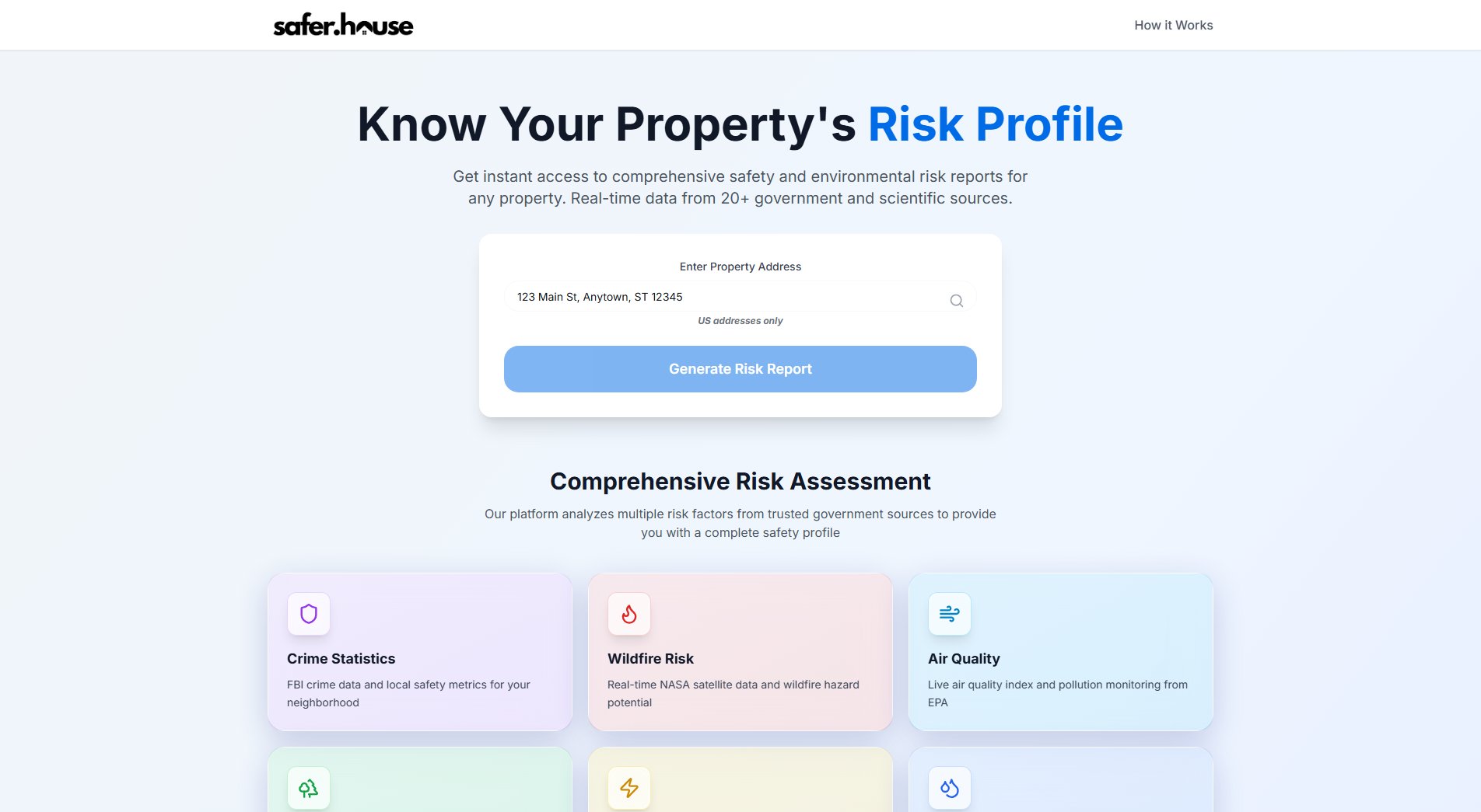
Safer House Official screenshot of the tool interface
What Can Safer House Do? Key Features
Comprehensive Risk Assessment
Safer House analyzes multiple risk factors from trusted government sources to provide a complete safety profile. The platform's proprietary algorithm compiles data points across various categories to generate a holistic view of property risks.
Crime Statistics
Access FBI crime data and local safety metrics for any neighborhood. This feature provides detailed information about crime rates, types of offenses, and safety trends in the immediate vicinity of the property.
Wildfire Risk Assessment
Utilizing real-time NASA satellite data and wildfire hazard potential metrics, this feature evaluates the property's vulnerability to wildfires, including historical fire data and predictive modeling.
Environmental Hazard Monitoring
The platform tracks EPA toxic facilities and environmental hazards near the property, including information about Superfund sites, industrial facilities, and other potential contamination sources.
Emergency Services Proximity
Detailed information about the nearest emergency services including hospitals, fire departments, and police stations, with distance measurements and estimated response times.
SaferScore™ Rating System
A proprietary scoring system that aggregates all risk factors into an easy-to-understand numerical rating and qualitative assessment (Excellent, Good, Moderate, etc.) for quick property comparisons.
Multi-Source Data Integration
The platform integrates data from 20+ authoritative sources including USGS for earthquake data, FEMA for flood zones, and EPA for air and water quality, ensuring comprehensive coverage of potential risks.
Best Safer House Use Cases & Applications
Home Buying Decision
Prospective home buyers can assess potential properties for hidden risks before making purchase decisions. A family might avoid a home with high flood risk despite its attractive price, while another might prioritize areas with excellent air quality for health reasons.
Rental Property Evaluation
Landlords and property managers can use Safer House reports to assess and disclose property risks to potential tenants, while renters can evaluate neighborhood safety before signing leases.
Insurance Premium Estimation
Insurance providers and policy seekers can use the detailed risk assessments to estimate appropriate coverage levels and premiums based on quantified property risks.
Community Safety Planning
Local governments and community organizations can aggregate reports to identify high-risk areas that may need additional safety infrastructure or emergency preparedness resources.
How to Use Safer House: Step-by-Step Guide
Enter the property address in the search field (US addresses only). The system accepts both residential and commercial property addresses.
Click 'Generate Risk Report' to initiate the data collection process. The system will query all available data sources in real-time.
View the comprehensive report, which typically generates within seconds. The report includes the SaferScore™ rating and detailed breakdowns for each risk category.
Navigate through different sections of the report to examine specific risk factors like crime statistics, environmental hazards, or natural disaster risks in detail.
Use the 'Compare' feature to evaluate multiple properties side by side, or save reports for future reference and monitoring.
Safer House Pros and Cons: Honest Review
Pros
Considerations
Is Safer House Worth It? FAQ & Reviews
Safer House uses real-time data feeds where available (like air quality and wildfire risk) and updates other datasets daily or weekly from government sources. The most recent update date is shown for each data category in your report.
Yes, Safer House reports work for both residential and commercial properties. However, some risk assessments like crime statistics may be more neighborhood-focused than property-specific for commercial locations.
Our flood risk data comes directly from FEMA flood maps, which are the official source for flood zone designations. However, these should be verified with professional surveys for precise elevation data when making critical decisions.
We temporarily store address queries to generate reports but do not retain them long-term for individual users. Our privacy policy details our data handling practices.
Currently Safer House only supports US addresses due to data source limitations. We may expand to other countries as we establish partnerships with international data providers.
