MapGO
Explore and measure distances with precise geographic tools
What is MapGO? Complete Overview
MapGO is a powerful geographic tool designed to help users explore locations and measure distances with precision. It allows users to search for any coordinates or locations, explore administrative hierarchies, and calculate distances to borders, coastlines, and between points. Ideal for travelers, researchers, and logistics professionals, MapGO simplifies geographic analysis and navigation with intuitive features.
MapGO Interface & Screenshots
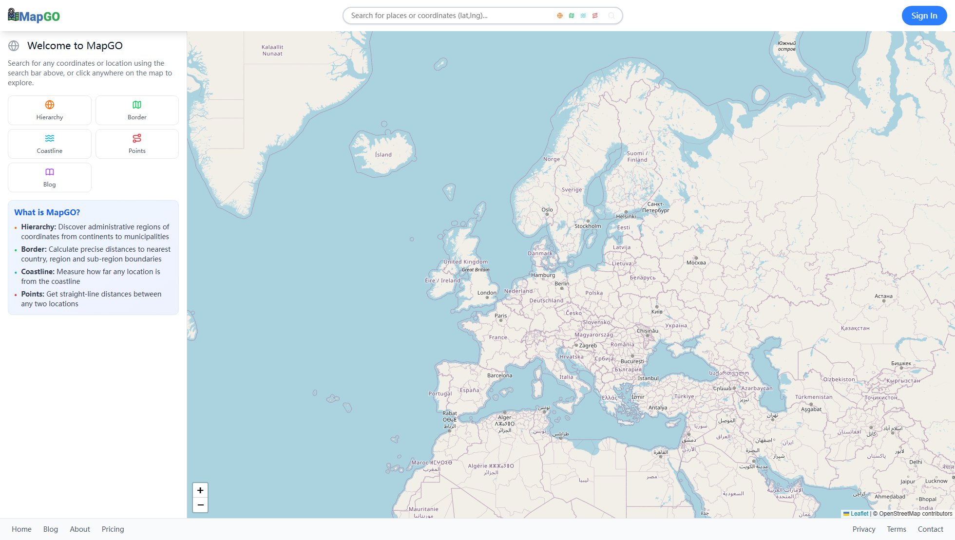
MapGO Official screenshot of the tool interface
What Can MapGO Do? Key Features
Hierarchy
Discover the administrative regions of any coordinates, from continents down to municipalities. This feature helps users understand the geographic and political divisions of any location, making it useful for research, planning, and navigation.
Border
Calculate precise distances to the nearest country, region, and sub-region boundaries. This is particularly useful for travelers, logistics professionals, and researchers who need to understand proximity to political or administrative borders.
Coastline
Measure how far any location is from the nearest coastline. This feature is beneficial for marine researchers, real estate professionals, and anyone interested in coastal geography.
Points
Get straight-line distances between any two locations. This tool is essential for logistics, urban planning, and anyone needing to calculate the shortest path between two points on a map.
Best MapGO Use Cases & Applications
Travel Planning
Travelers can use MapGO to measure distances between destinations, understand administrative regions, and plan routes efficiently.
Logistics and Supply Chain
Logistics professionals can calculate straight-line distances between warehouses and delivery points to optimize routes and reduce costs.
Academic Research
Researchers can explore geographic hierarchies and measure distances to borders or coastlines for studies in geography, political science, or environmental science.
How to Use MapGO: Step-by-Step Guide
Open MapGO in your web browser by visiting https://mapgo.io.
Use the search bar to enter any coordinates or location name you wish to explore.
Click anywhere on the map to explore the area and access features like Hierarchy, Border, Coastline, and Points.
Select the desired feature (e.g., 'Border') to calculate distances or explore administrative regions.
Review the results displayed on the map and use the information for your specific needs.
MapGO Pros and Cons: Honest Review
Pros
Considerations
Is MapGO Worth It? FAQ & Reviews
Yes, MapGO is currently free to use with all basic features available at no cost.
You can measure straight-line distances between points, distances to borders, and distances to coastlines.
Yes, MapGO can be used for both personal and commercial purposes without any restrictions.
Yes, MapGO is accessible via web browsers on both desktop and mobile devices.
MapGO uses OpenStreetMap data and Leaflet.js for map rendering.

