Irregular Shapes Area Calculator
Free online tool for measuring irregular areas with image upload support
What is Irregular Shapes Area Calculator? Complete Overview
The Irregular Shapes Area Calculator is a free, fast and easy-to-use tool designed for calculating areas of irregular shapes. It supports polygon drawing directly on a canvas or tracing shapes on uploaded images, providing real-time calculation results. The tool is particularly useful for land surveying, architectural design, agriculture, construction, real estate, landscaping and various other fields where area measurement is required. With its user-friendly interface, anyone can quickly estimate areas without needing technical expertise. The calculator supports multiple measurement units including square meters, feet, acres, and more, making it versatile for different regional preferences and professional needs.
Irregular Shapes Area Calculator Interface & Screenshots

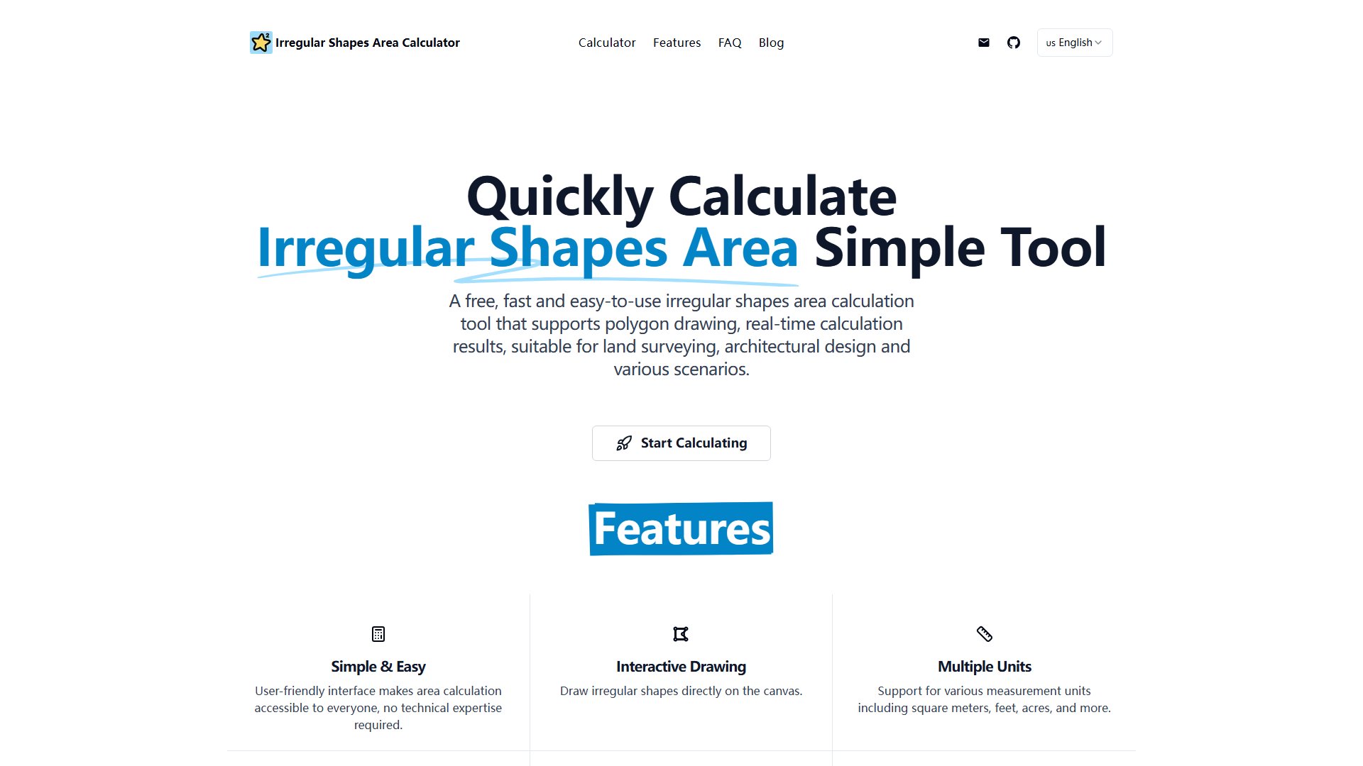
Irregular Shapes Area Calculator Official screenshot of the tool interface
What Can Irregular Shapes Area Calculator Do? Key Features
Interactive Drawing
Users can draw irregular shapes directly on the canvas by clicking points to create vertices. The tool automatically connects these points to form polygons and calculates the enclosed area in real-time.
Image Upload Support
The calculator allows users to upload images (JPG, PNG formats) and trace irregular shapes directly on them. This feature is particularly useful for measuring areas from aerial photos, maps, or any visual representation of spaces.
Multiple Measurement Units
Supports various units including meters (m), centimeters (cm), inches (in), and feet (ft). Users can easily switch between units depending on their measurement needs.
Real-time Calculation
Provides instant area calculations as users draw or modify their irregular shapes, enabling quick adjustments and immediate feedback.
Multi-field Applications
Suitable for diverse applications including land surveying, architectural design, agriculture, construction, real estate, landscaping, and general daily area estimation tasks.
Best Irregular Shapes Area Calculator Use Cases & Applications
Land Surveying
Surveyors can quickly estimate plot areas from aerial photographs or maps by tracing property boundaries, saving time compared to traditional measurement methods.
Architectural Planning
Architects can measure irregular floor spaces or roof areas from building plans or photographs, aiding in material estimation and project planning.
Agricultural Land Measurement
Farmers can measure field areas from satellite images to plan crop planting, irrigation systems, or calculate fertilizer requirements.
Real Estate Assessment
Agents can quickly estimate property sizes from listing photos, providing approximate area information to potential buyers.
Home Improvement Projects
Homeowners can measure garden spaces, patios, or rooms from photos to plan landscaping projects or flooring installations.
How to Use Irregular Shapes Area Calculator: Step-by-Step Guide
Access the tool at irregularcalc.com. No registration or login is required.
Choose between drawing directly on the canvas or uploading an image containing the area you want to measure.
For image upload: Click the upload button and select your image file. Wait for it to load on the canvas.
Trace the boundaries of your irregular shape by clicking points around its perimeter. The tool will automatically connect these points.
View the calculated area in real-time as you draw. Adjust points as needed for accuracy.
Select your preferred measurement unit from the dropdown menu to view results in different units.
Irregular Shapes Area Calculator Pros and Cons: Honest Review
Pros
Considerations
Is Irregular Shapes Area Calculator Worth It? FAQ & Reviews
This tool is designed for daily measurement tasks, perfect for estimating plot areas, surface areas, roof areas, and other irregular shapes. It's ideal for manually tracing irregular shapes on uploaded images to calculate approximate areas for general estimation purposes.
Simply upload an image containing the area you want to measure, then manually trace the boundaries by clicking points around the irregular shape. The tool will automatically connect your points and calculate the enclosed area. This method works great for aerial photos, maps, or any visual representation of areas.
You can measure any irregular area including plot areas, surface areas, roof areas, garden spaces, floor plans, land parcels, or any other irregular shapes visible in your images.
The calculator supports common length units including meters (m), centimeters (cm), inches (in), and feet (ft). You can easily switch between units depending on your measurement needs.
Yes, this area calculator is completely free to use. There are no registration requirements, hidden fees, or usage limitations.
This tool is primarily designed for desktop browsers and provides the best experience on larger screens. While it may work on tablets, it's not optimized for mobile phones due to the precision required for tracing irregular shapes.
This tool provides area estimations suitable for general daily use and planning purposes. The accuracy depends on how precisely you trace the boundaries and the quality of your uploaded image.


