US Map With States
Free high-quality US maps for all your projects
What is US Map With States? Complete Overview
US Map With States provides free, high-quality maps of the United States, including state names and boundaries. These maps are available in multiple formats (JPG, PNG, SVG) and are perfect for a variety of uses, from educational purposes to professional presentations. The maps are current for 2025 and come with a simple attribution requirement, making them accessible for both personal and commercial use. Whether you're a teacher, blogger, designer, or business professional, these maps offer a hassle-free solution for all your mapping needs.
US Map With States Interface & Screenshots
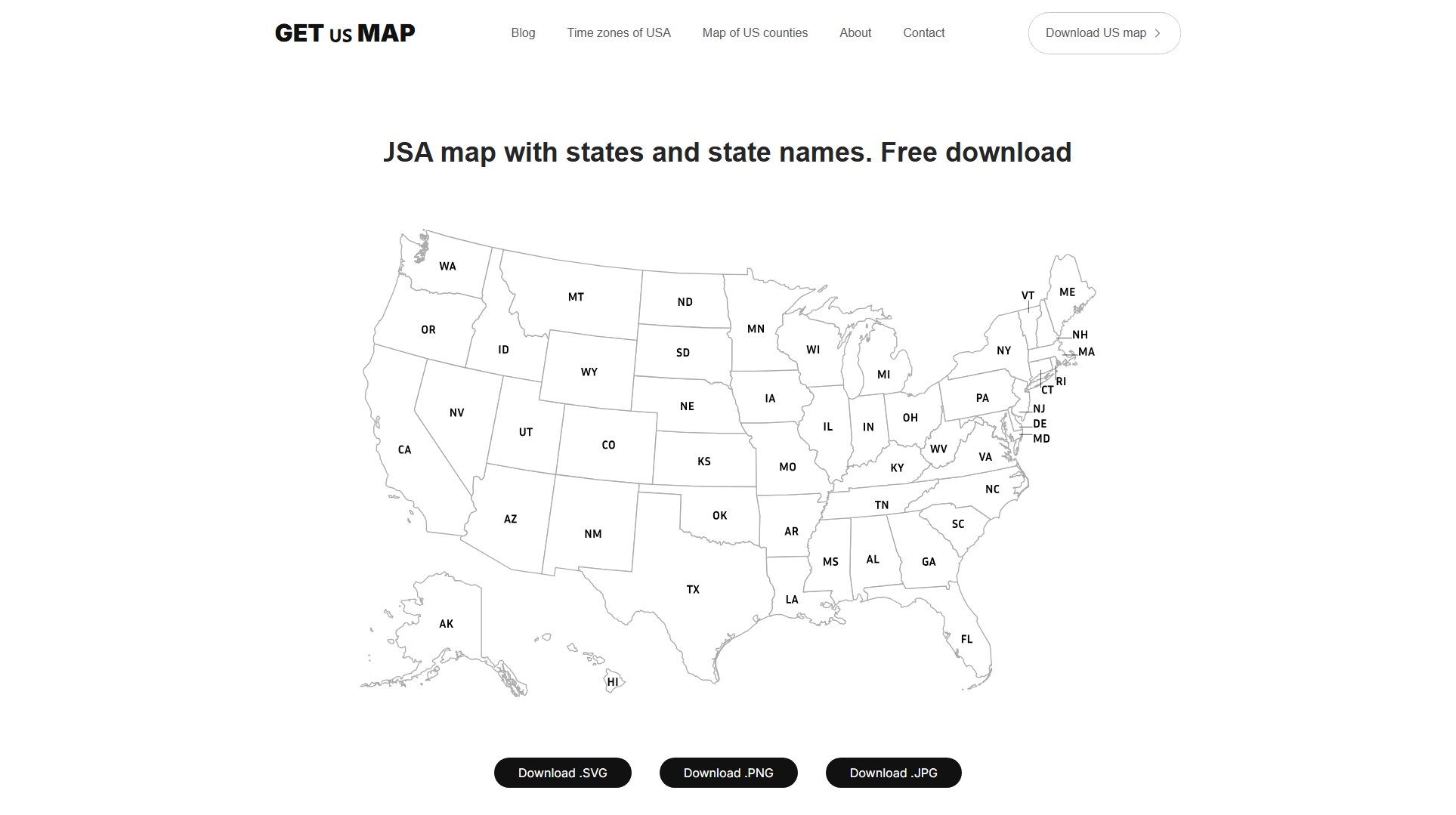
US Map With States Official screenshot of the tool interface
What Can US Map With States Do? Key Features
Multiple File Formats
Choose from JPG, PNG, or SVG formats to suit your project needs. JPG is ideal for websites and digital documents, PNG offers a transparent background for versatile use, and SVG provides scalable vector graphics for any size requirement without losing clarity.
Free Forever
All maps are available for free download with no hidden fees or subscription requirements. Simply download and use the maps as needed, with no restrictions on usage.
Simple Attribution
Use the maps for any purpose, commercial or personal, with just a simple credit link back to getusmap.com. This easy requirement grants you full rights to modify, print, publish, or build with the maps.
Current for 2025
All maps are up-to-date with the latest state boundaries and names, ensuring accuracy for your projects in 2025 and beyond.
High Quality
Maps are provided in high resolution (300dpi for JPG) and vector format (SVG), ensuring they look professional in any application, from digital displays to large prints.
Best US Map With States Use Cases & Applications
Education & Learning
Teachers can use the blank US map for geography lessons, history projects, and classroom activities. Students can mark states, capitals, or historical events for interactive learning.
Professional Presentations
Business professionals can incorporate the maps into market reports, advertising creatives, and sales territory presentations. The high-quality formats ensure clarity and professionalism in client meetings.
Creative Content
Bloggers, YouTubers, and podcasters can use the maps as visuals in their content. The transparent PNG and scalable SVG formats make it easy to integrate maps into various media without quality loss.
How to Use US Map With States: Step-by-Step Guide
Visit the website getusmap.com and navigate to the download section.
Choose your preferred file format (JPG, PNG, or SVG) based on your project needs.
Click the download button for your selected format to save the map to your device.
Use the map in your project, ensuring to include a credit link back to getusmap.com where appropriate.
US Map With States Pros and Cons: Honest Review
Pros
Considerations
Is US Map With States Worth It? FAQ & Reviews
We offer three file formats: JPG for digital use, PNG with transparent background, and SVG for scalable vector graphics.
Yes, you can use the maps for commercial purposes as long as you provide a credit link back to getusmap.com.
Our maps are free, high-quality, and available in multiple formats with a simple attribution requirement, making them versatile for any project.
Yes, our maps include state names and clear boundaries, updated for 2025.
