GeoGuessr.ai
AI-powered GeoGuessr coach for mastering location guessing
What is GeoGuessr.ai? Complete Overview
GeoGuessr.ai is an AI-powered coaching tool designed to help players improve their GeoGuessr skills. The platform analyzes uploaded game screenshots to identify visual clues and teach players how to recognize location markers like bollards, signs, and landscape features. With a 99.2% accuracy rate and experience analyzing over 10,000 images across 50+ countries, the AI provides educational insights rather than just answers. The service offers 3 free analyses per day, making it accessible for casual players while serving as a training tool for competitive GeoGuessr enthusiasts. The AI explains its reasoning process, turning each analysis into a learning opportunity about geographical meta clues.
GeoGuessr.ai Interface & Screenshots
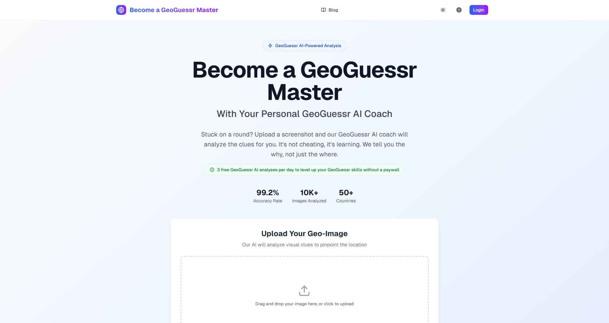
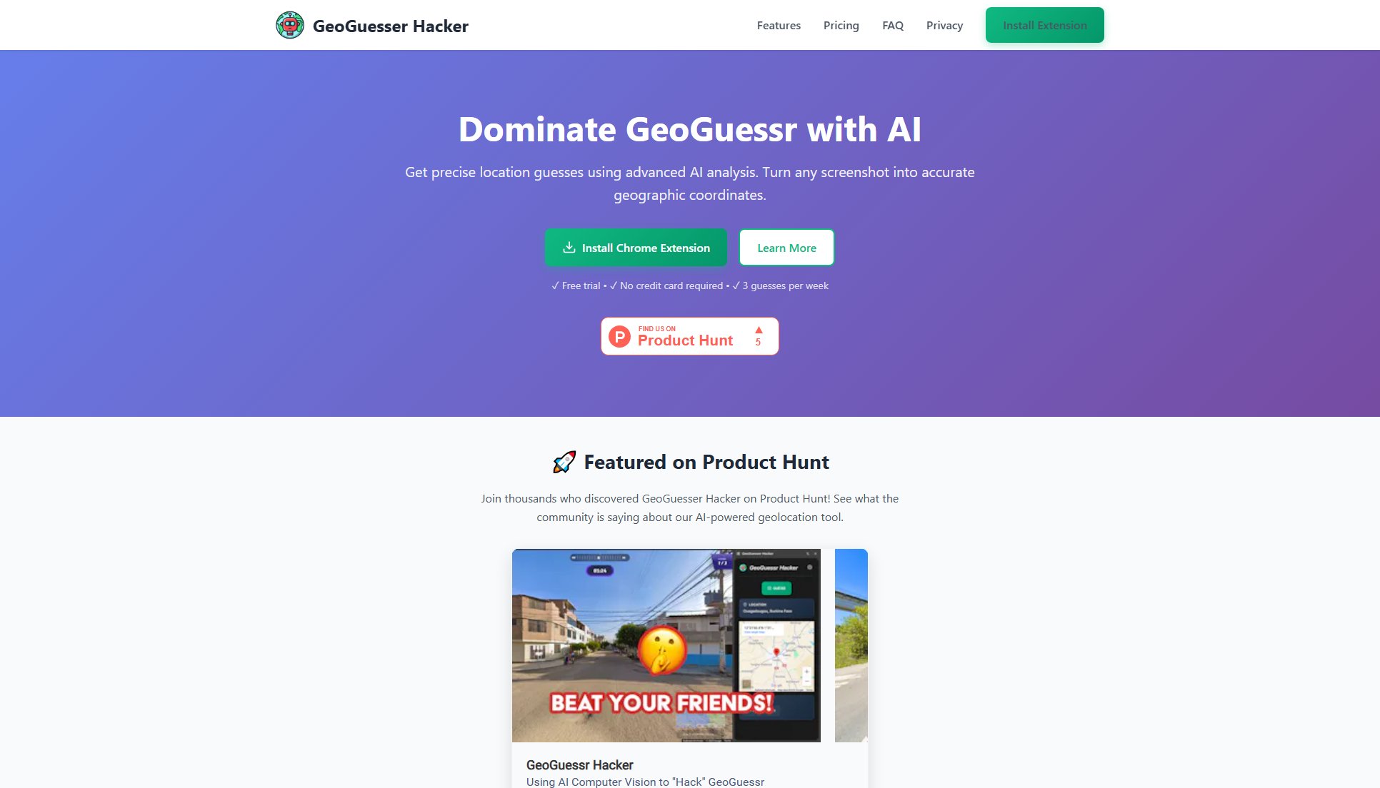
GeoGuessr.ai Official screenshot of the tool interface
What Can GeoGuessr.ai Do? Key Features
AI-Powered Analysis
Our advanced computer vision AI examines uploaded GeoGuessr screenshots to identify telltale signs of location including infrastructure, vegetation, architecture, and geographical markers with 99.2% accuracy.
Educational Feedback
Rather than simply revealing locations, the AI explains which visual clues led to its conclusions, teaching users to recognize bollards, signs, license plates, and other geographical meta indicators.
Free Daily Analyses
Users receive 3 complimentary AI analyses per day, allowing regular practice without immediate paywall restrictions while maintaining fair usage limits.
Global Coverage
Trained on data from 50+ countries, the AI recognizes diverse geographical markers across different continents and cultural regions for comprehensive GeoGuessr support.
Best GeoGuessr.ai Use Cases & Applications
Skill Development
New GeoGuessr players use daily analyses to systematically learn country-specific markers like bollard designs, road markings, and architectural styles that distinguish locations.
Competitive Preparation
Tournament participants analyze difficult rounds after matches to understand what clues they missed and improve their competitive performance.
Educational Tool
Geography teachers incorporate GeoGuessr AI analyses into lessons to demonstrate how visual environmental analysis connects to real-world geographical knowledge.
How to Use GeoGuessr.ai: Step-by-Step Guide
Capture a screenshot during your GeoGuessr game when you encounter a challenging location or want to learn more about the visual clues present.
Visit GeoGuessr.ai and either drag & drop your screenshot onto the upload area or click to browse your files and select the image.
Wait briefly while our AI processes the image (typically under 10 seconds) to analyze all visible geographical markers and clues.
Review the AI's analysis which will highlight key location indicators and explain how they point to specific countries or regions.
GeoGuessr.ai Pros and Cons: Honest Review
Pros
Considerations
Is GeoGuessr.ai Worth It? FAQ & Reviews
The AI uses computer vision trained on thousands of GeoGuessr images to recognize patterns in infrastructure, vegetation, and other environmental markers that indicate specific locations.
No - the tool is designed for educational purposes, explaining clues rather than giving direct answers. Many players use it to improve their independent guessing skills.
Our current accuracy rate is 99.2% based on testing across diverse geographical locations and image conditions.
Clear screenshots showing multiple environmental elements (roads, signs, buildings, vegetation) yield the most comprehensive analyses.
Users receive 3 free analyses per day, with the counter resetting every 24 hours.
