AeroMegh
Advanced GeoAI Platform for Drone Data Analytics
What is AeroMegh? Complete Overview
AeroMegh is a comprehensive GeoAI platform designed to transform drone data into actionable intelligence. It integrates photogrammetry, AI analysis, and object detection into one seamless solution, catering to professionals in surveying, mapping, and infrastructure monitoring. The platform addresses the challenges of fragmented drone data analytics by offering a unified workflow that reduces complexity and enhances accuracy. AeroMegh is ideal for industries such as power transmission, wind energy, urban planning, and mining, providing specialized tools for each sector. With its user-friendly interface and scalable cloud infrastructure, AeroMegh delivers professional-grade results without requiring extensive technical expertise.
AeroMegh Interface & Screenshots
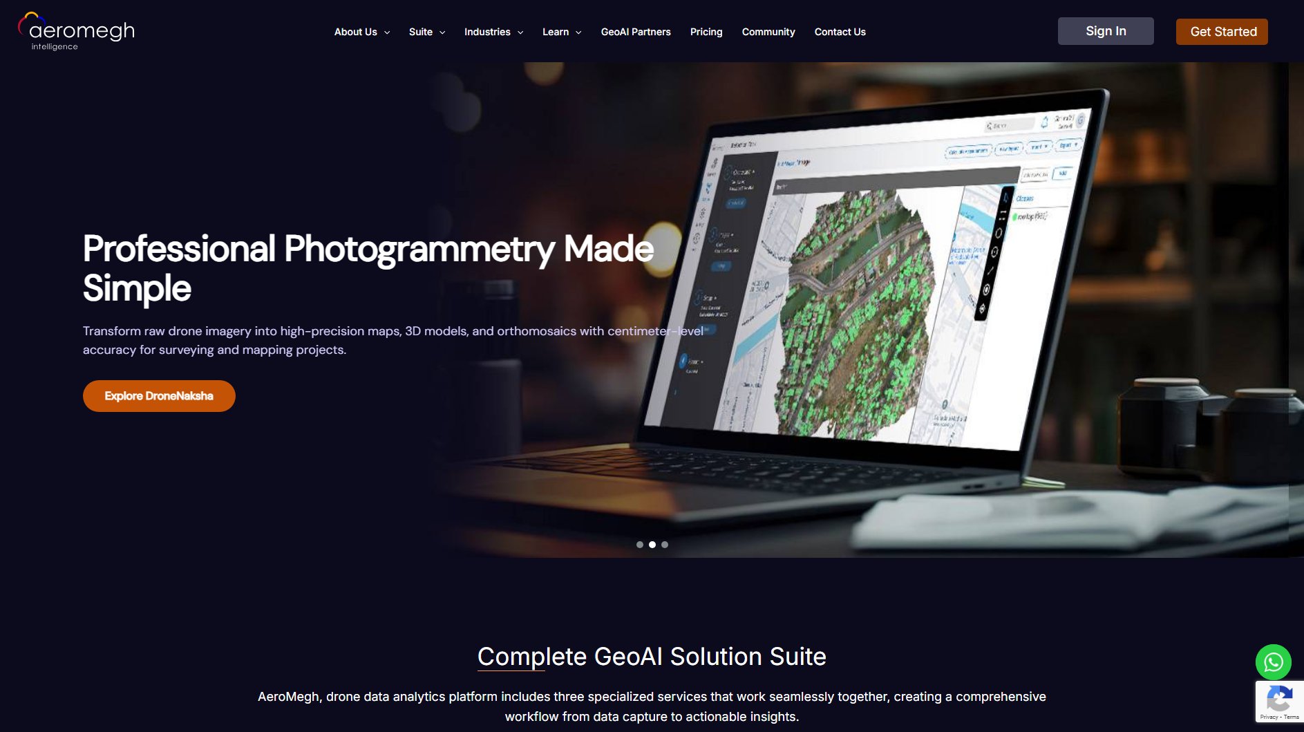
AeroMegh Official screenshot of the tool interface
What Can AeroMegh Do? Key Features
DroneNaksha - Professional Photogrammetry
DroneNaksha transforms raw drone imagery into high-precision maps, 3D models, and orthomosaics with centimeter-level accuracy. It is perfect for surveying, mapping, and volumetric calculations, offering industry-leading photogrammetry capabilities.
AeroMegh Intelligence - AI on GIS
This feature leverages advanced AI to analyze processed GIS imagery and geospatial data. Users can build custom ML models without coding, detect patterns in georeferenced imagery, and generate spatial reports for location-based insights.
PicStork - AI on Video and Images
PicStork specializes in real-time object detection and feature identification on raw drone videos and unprocessed imagery. It is ideal for live monitoring, surveillance, and infrastructure inspection, providing immediate insights without photogrammetric processing.
AI-Powered Rooftop Analysis
AeroMegh's AI accurately measures rooftop areas, counts rooftops, and locates them using precise GPS coordinates. This feature is essential for urban planning, enabling the detection of unauthorized constructions and generating comprehensive reports for enforcement.
Automated Report Generation
The platform automatically generates detailed reports highlighting unauthorized structures, complete with area, distance, and location data. These reports support legal and regulatory actions with accurate AI insights.
Best AeroMegh Use Cases & Applications
Urban Planning
AeroMegh helps urban planners monitor infrastructure development, detect unauthorized constructions, and generate compliance reports. The AI-powered rooftop analysis ensures accurate tracking of urban growth and supports data-driven decision-making.
Power Transmission
The platform enables power companies to inspect transmission lines, identify faults, and monitor vegetation encroachment using drone imagery. AI-driven object detection reduces manual inspection efforts and improves accuracy.
Wind Energy
AeroMegh assists wind farm operators in monitoring turbine health, detecting blade damage, and optimizing maintenance schedules. The platform's photogrammetry capabilities provide detailed 3D models for thorough inspections.
Mining & Resource Management
Mining companies use AeroMegh for volumetric calculations, terrain analysis, and progress monitoring. The platform's high-precision outputs ensure accurate resource estimation and operational planning.
How to Use AeroMegh: Step-by-Step Guide
Upload your raw drone imagery or video footage to the AeroMegh platform. The system supports various formats and ensures seamless integration with your existing data.
Select the desired processing option: photogrammetry (DroneNaksha), GIS analysis (AeroMegh Intelligence), or object detection (PicStork). Each option is tailored to specific use cases.
Configure the processing parameters based on your project requirements. The platform offers intuitive settings for accuracy, output format, and analysis depth.
Initiate the processing. AeroMegh's cloud infrastructure ensures fast and reliable results, even for large datasets.
Review the generated outputs, including maps, 3D models, or AI-detected objects. The platform allows for easy visualization and further analysis.
Export or share the results in your preferred format. AeroMegh supports various export options, including GeoJSON, PDF, and interactive reports.
AeroMegh Pros and Cons: Honest Review
Pros
Considerations
Is AeroMegh Worth It? FAQ & Reviews
AeroMegh is designed for industries such as urban planning, power transmission, wind energy, solar energy, highway infrastructure, and mining. Each sector benefits from specialized tools tailored to their unique needs.
No, AeroMegh's user-friendly interface allows users to build custom ML models and perform advanced analyses without any coding knowledge.
DroneNaksha delivers centimeter-level accuracy, making it suitable for professional surveying, mapping, and volumetric calculations.
Yes, AeroMegh offers a free trial that allows you to explore the platform's capabilities before committing to a paid plan.
AeroMegh supports various export formats, including GeoJSON, PDF, and interactive reports, ensuring compatibility with your existing workflows.
